Tens of thousands remain under evacuation orders across Washington, Oregon, and British Columbia as record-breaking river levels threaten communities despite the storm system finally moving on.
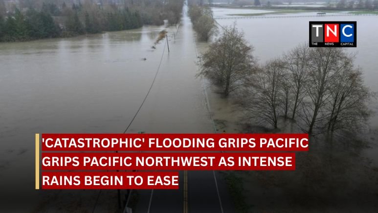
The Pacific Northwest is dealing with the fallout from a “catastrophic” flooding event today (Friday 12 December), as an extreme atmospheric river that’s been hammering the region for days finally starts to let up. The heaviest rains have stopped, but officials are warning the danger is far from over. Major rivers are still hitting historic highs, and floodwaters are swamping towns on both sides of the US-Canada border.
The crisis was triggered by a relentless plume of moisture stretching 7,000 miles from the Philippines. It’s forced the evacuation of an estimated 100,000 people in Washington state alone. Governor Bob Ferguson declared a statewide emergency and deployed the National Guard to help with rescues. Critical infrastructure is a mess: sections of Interstate 5 and US Route 12 are either underwater or cut off by mudslides.
The Snohomish and Skagit rivers in Washington have shattered all-time flood records. The Skagit hit a crest of 42 feet near Mount Vernon. Up in British Columbia, the Fraser Valley has been hit just as hard, with highways shut down and evacuation orders issued for properties in Abbotsford as dikes struggle to hold back the water.
Despite the massive destruction, emergency management officials say there are currently no reports of casualties or missing persons directly linked to the flooding in Washington. They’re crediting early warnings and mass evacuations for that.
“Catastrophic flooding effects are likely to continue for several days,” the US National Weather Service warned in its latest update, telling residents not to rush back to evacuated areas.
“Lives will be at stake in the coming days,” Governor Ferguson said earlier in the week, calling this a “worst-case scenario” for the region’s river valleys.
This event is being classified as an “AR5,” the most severe category of atmospheric river, and it ranks among the strongest to ever hit the Puget Sound region. The storm dumped over 10 inches of rain in some areas within 72 hours, falling on ground that was already soaked from earlier storms. Add in melting mountain snowpack, and you’ve got a “perfect storm” for runoff.
The disaster is part of a bigger pattern of extreme weather hitting the continent. The US East Coast is getting frozen by polar vortex conditions while the West is drowning in unseasonal warmth and rain. Scientists point to these “whiplash” events, swinging from drought to deluge, as a clear sign of climate change impacts in the region.
The immediate rainfall has stopped, but there’s a lag effect. River levels in some downstream areas might not peak until the weekend. Recovery is going to take months. There’s already significant damage to homes, farms, and transport networks becoming visible as the water slowly goes down. Authorities are keeping an eye out for secondary hazards like landslides because the soaked terrain is still unstable.


Leave a comment